Upper Mustang

Upper Mustang

High, dry desert country north of the Annapurnas, with Tibetan-style villages, old monasteries, and the walled town of Lo Manthang.

Start booking

14 days4,230 m high pointModerate

Route map

See the route on the terrain.

Tap a numbered stop to see its altitude, what it is like, and how far it is to the next one.

Route map

Upper Mustang

Loading route map

Loading the terrain, the route line, and the numbered stops.

About the route

Jomsom to Lo Manthang

High desert country with monastery villages and valleys a jeep can reach, on the way north to Lo Manthang. The last stop marked on the map is Lo Manthang, at 3,840 m.

Along the route

Stop 1 of 50%
From Jomsom
0 km
Whole route
~57 km

Elevation profile

Lo Manthang · 3,840 m

Start · Jomsom
2,743 m
Highest point
↑ 4,230 m
Net climb
1,487 m

This section

Jomsom to Kagbeni

Est. distance
7 km
Stop type
Day stop
14 days
Duration
4,230m
Max altitude
May-Oct
Best seasons
$3,350+
Starting rate

Permits and access

Permits
Restricted Area Permit, ACAP, Licensed guide required
Access
Flight or jeep to Jomsom
Stay style
Kathmandu and Pokhara hotels, comfortable lodges on the route

Customize your trip

jeep
Travel the whole route overland by private jeep, with more time for villages and monasteries.
flight
Fly to Jomsom to shorten the trip.
Build a proposal

Day-by-day itinerary

Day by day on the trail.

Sample stages from a partner operator's published itinerary for this trek. Ask us for the full day-by-day plan.


7

Day 7 · . · .

Lo-Manthang (exploration day)

↑ .

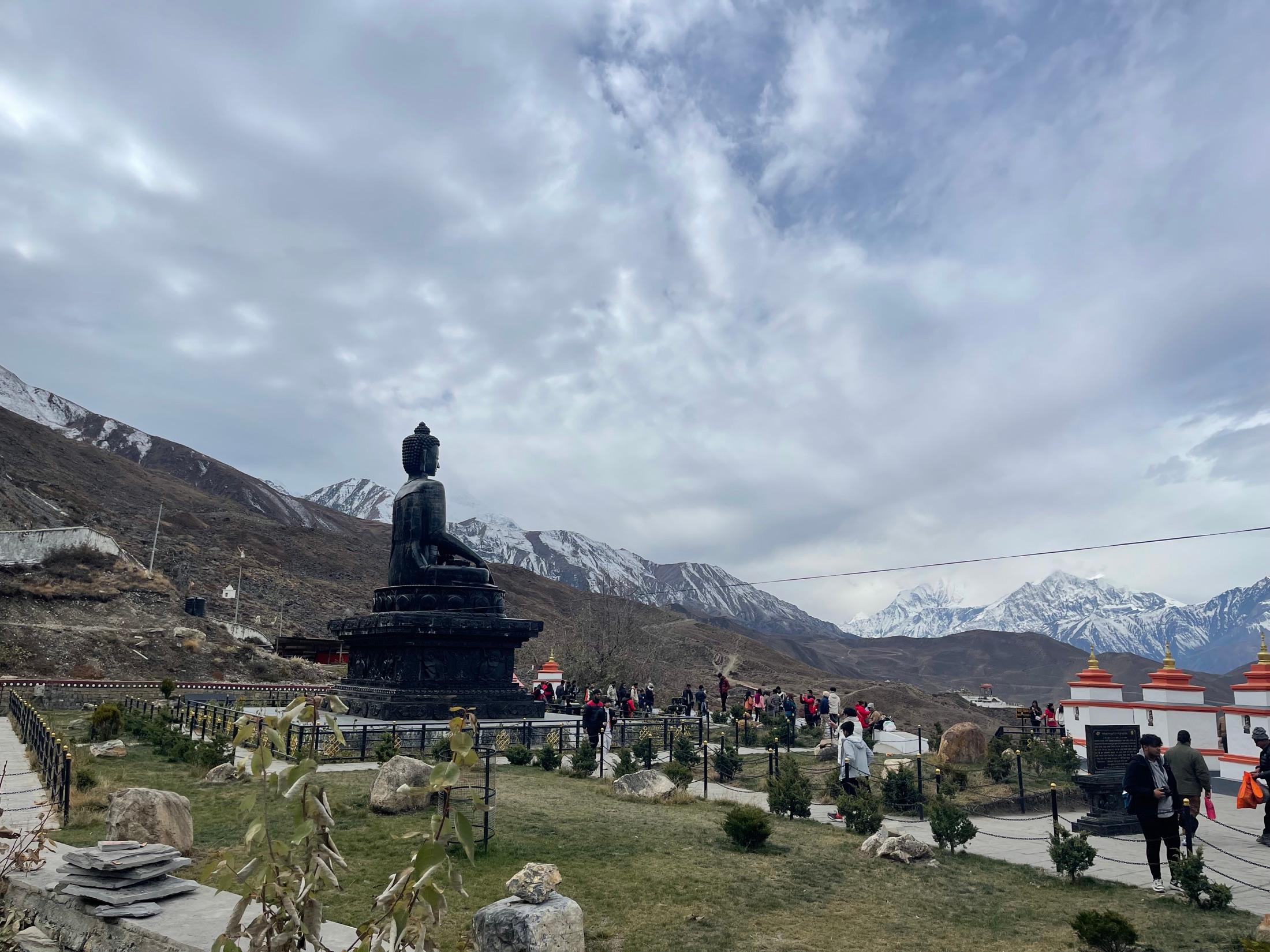
Lo-Manthang means the “plains of prayer.” The city is a walled fortress of old times with houses tightly packed behind the walls, and a maze of narrow alleys to explore. The king’s palace, in which he still resides, is easily noticeable, as it is the largest residence in Lo-Manthang. It is also possible to visit 3 monasteries – the Chamba Lakhang which houses the massive 45 foot statue of Maitreya (the future Buddha), the Thugchen Lakhang with several large images of Sakyamuki, Avolokitsevara and Maitreya and Chodi of the Sakya Sect which has several monks in residence and offers us the chance to join in prayer and chanting. Half way to the King’s summer palace in Namgyal, is the Namgyal Monastery. It is the largest monastery in Mustang and is perched on a hillside above the village. Its massive walls are painted in scripts of grey, white and yellow. There is a large courtyard surrounded by galleries and the main hall contains a large altar with splendid statues, images and Thankas hanging from the pillars. Lo-Manthang has a post office, health post; police check post and radio communication with Jomsom and Kathamndu.

6

Day 6 · 5 hrs · 10 kms

Tsarang (3650m) – Lo-Manthang (3760m)

↑ 110m ascent

After our initial descent, the trail follows a gentle but continuous climb with increasingly beautiful views. High sandstone cliffs with numerous caves flank our east and the Mustang Himal peaks are visible stretching towards Tibet. From the Lo-Manthang Pass (3950m) we first see the village of Namgyal, and then Lo-Manthang itself, the only walled village on this route. It contains the Royal Palace of the King of Mustang and will be our base camp for the next 3 nights. Hiking hours: 5

5

Day 5 · 6 hrs · 11 kms

Ghami (3490m) – Tsarang (Charang) (3650m)

↑ 160m ascent

We cross the river on the other side of Ghami village. There is a hospital following 300m long Mani wall. The Mani wall is the longest in Upper Mustang and is said to be the intestine of the demon killed by Padmasambhav (Guru Rimpoche). Tsarang (3650m), a Dzong which formerly housed a king of the region. Tsarang is situated on the edge of a beautiful cliff. The name Tsarang has been derived from the Tibetan word Chaptrun meaning cook’s crest. The crest being the narrow rocky ridge upon which the Castle stands. There is a Monastery which was built in 1385AD and a 5 storied Palace built in 1378AD. The Palace has 108 volumes of Kangyur Text engraved in Gold. Hiking hours: 6

3

Day 3 · 6 hrs · 10 kms

Chaile (3050m) – Syanboche (3920m)

↑ 870m ascent

We climb until we reach the Chotare Lopcha Pass (3625 m) where it offers a good view towards Samar, the Kali Gandaki Valley and snow-capped peaks in the distance. We then follow the contour of the mountain to Samar (3700 m) named after the red outcrop of rocks. We stop for lunch at Samar. Then we take the lower route to visit Chunsi cave red painted monastery, which is an impressive and worth to visit. This is Rangchyung Chorten, one of the most sacred places in Mustang. Sometime it is possible to see the rare blue mountain sheep in this area. Our today’s destination is Syanboche (3920 m). Hiking hours: 6.

What's covered

Included & excluded at a glance.


Included

  • Total of two nights' accommodation in Pokhara (before and after the trek) at the partner operator's guesthouse
  • Guide
  • Assistants, (maximum weight to carry is 12 kg for female assistant and 15 kg for male assistant).
  • 3 meals per day, afternoon tea & snacks,
  • Accommodation is typically arranged on a twin-share basis, though peak-season departures may occasionally require a triple or four-bed room.
  • Annapurna Park entry, TIMS fees and Special permit,

Not included

  • Mineral water
  • Beverages- soft and hard
  • Extra dessert
  • Souvenirs
  • Tipping to staff
  • Any entry fee during cultural (monastery/temple heritage visit)

Based on a partner operator's listing, “The Forbidden Kingdom of Nepal (Upper Mustang) (one way drive)”, last updated Mar 4, 2024.